Given the general aridity of the continent, Africa's rivers play a huge role for local residents. It is not surprising that their basin and shores are mostly densely populated. Agriculture is best developed in deltas, and fishing is not just an important activity, but a necessary condition for their survival. When it comes to measuring the length of rivers, researchers do not always agree on data. The primary reasons are inaccessibility, bends and drying out of the riverbed. 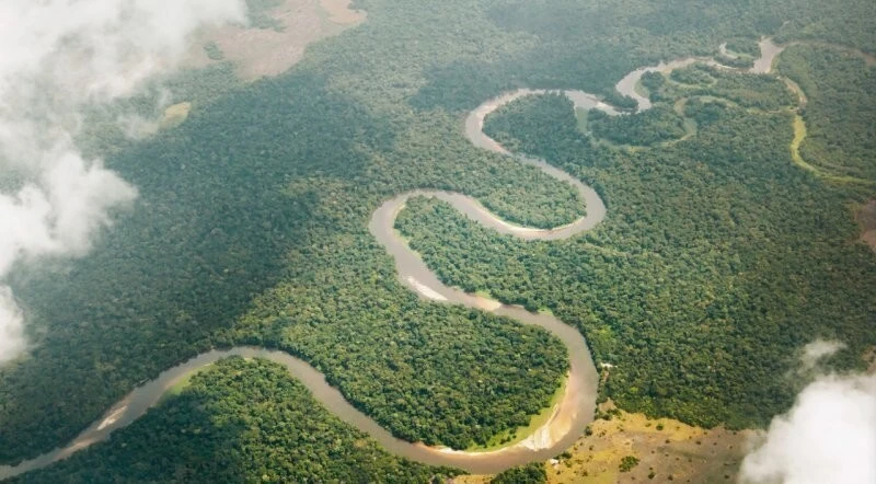
Among the waterways of the African continent, the Nile stands apart - the longest of the rivers. River tourism is an opportunity to see Africa in all its splendor. Picturesque green corners, animals hurrying to drink, natural attractions - all this is available to travelers in the Congo, Okavango, Jubba, Mary and other rivers.
Nile
The longest river in Africa. Territorially belongs to Egypt, Uganda, Sudan and South Sudan. There are many legends and disputes associated with the Nile. One of them concerns the location of the source of the river. The coastal zone is densely populated, especially in Egypt, where 97% of the country's population lives near the Nile. Every area of local life is connected with the river. There are unique species of fauna and flora, for example, Nile perch, reaching 140 kg.
The length of the river is 6852 km. 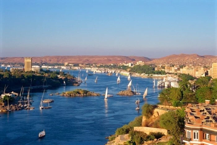
Congo
Occurs in Central Africa. There are other names: Zaire, Lualaba. There is a single extensive network of shipping routes. There are many cities on the river, including Kinshasa, the capital of the Democratic Republic of Congo. Attractions: Stanley Falls in seven stages and Livingston Falls, forming a cascade. Lakes Tanganyika and Kivu are part of the Congo water system.
The length of the river is 4374 km. 
Niger
The source is located in Guinea and is considered sacred by the natives. It flows through a total of 5 countries and carries its waters to the Gulf of Guinea. The channel resembles a boomerang in shape. There are ports, but shipping is possible only in some areas. In the Niger region, 3 national parks and a special protected zone - river basin management - have been established.
The length of the river is 4180 km. 
Zambezi
A river in the southern part of the black continent. It originates in the swamps of Zambia and crosses five more countries before flowing into the Indian Ocean. The reservoir is important for agriculture. In coastal areas there are populations of many species of animals: zebras, giraffes, crocodiles. The Zambezi is home to the bull shark, also called the bull shark. The main attraction is Victoria Falls.
The length of the river is 2574 km. 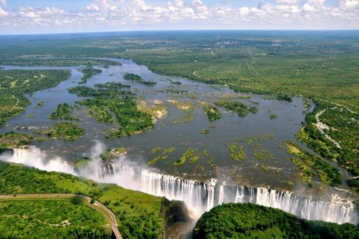
Ubangi
It is a tributary of the Congo and flows in central Africa. It is used for crossings, as the rainy season completely washes out many roads in the region. There are large cities like Bangui and small villages on the river. The M'Baiki area is considered the main area for pygmies. Main attractions: Elefan Falls, Azande Rapids, Zemongo Nature Reserve.
The length of the river is 2272 km. 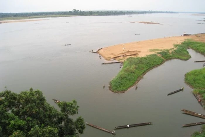
Orange
It belongs to the territory of three countries: Lesotho, Namibia and South Africa. Named after the Dutch Prince William and the Orange dynasty to which he belonged. Flows into the Atlantic Ocean. Brackish water from it periodically flows into the river bed. Shallow waters do not allow the use of ships for transportation. The basin is mostly covered by desert.
The length of the river is 2200 km. 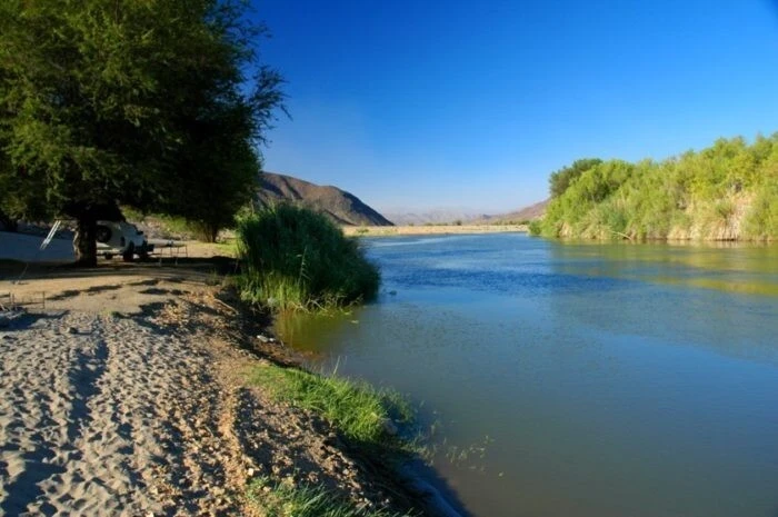
Kasai
The second largest tributary of the Congo. Refers to the central part of the continent. Part of the channel runs right along the border of the Democratic Republic of Congo and Angola. There is dense jungle around the shores. The food is mixed, rain and underground. Partially navigable, there is continuous fishing. Diamonds have been mined in the Kasai Basin for decades. The mines and mines are supplied with energy by 3 hydroelectric power stations.
The length of the river is 2153 km. 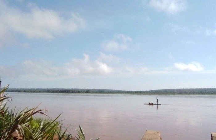
Blue Nile
Belongs in the territory of Sudan and Ethiopia. It arises from Lake Tana. Just under a third of the river is used for transporting people and goods. Part of the Blue Nile in Ethiopia is considered sacred. Water volumes are very dependent on the rainy season. Near the capital of Sudan it merges with the White Nile. Construction of the Hidase hydroelectric power station is underway. It should solve many problems in the region.
The length of the river is 1783 km. 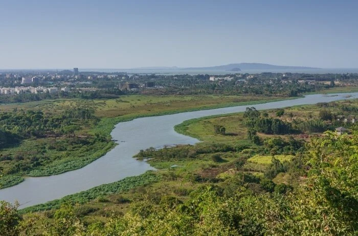
Limpopo
It starts at a mountain range in South Africa, and runs through Botswana, Zimbabwe and Mozambique to the Indian Ocean. Very winding, along the banks there are different reliefs from desert and savannah to hills. Partially navigable, may dry out in the upper sector. There is a lot of fish and shellfish near the mouth, including cod and oysters. The Kruger National Park is located near Limpopo.
The length of the river is 1750 km. 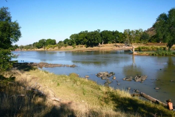
Senegal
It originates in Mali and flows along the border between Mauritania and Senegal. After floods, silt remains, increasing soil fertility. Since the river is actively used, environmental problems arise. Countries united to solve them. Several specially protected zones have been created: the Dzhuj ornithological reserve, the Chat-T-Bul reserve, and the Diavaling National Park.
The length of the river is 1610 km. 
Okavango
It originates in the Angolan mountains and then carries its waters to Namibia and Botswana. One of the attractions is the rapids Popa waterfalls. The Okavango does not flow anywhere; it winds through the delta and dissolves into the swamps on the outskirts of the Kalahari. There are particularly picturesque areas with acacias, water lilies and reed thickets. The shore is not populated, there are no enterprises, so the water remains clean.
The length of the river is 1600 km. 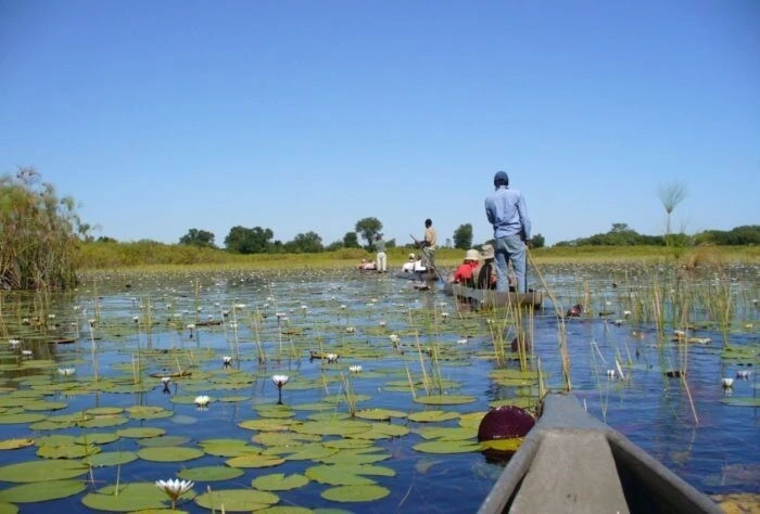
Volta
Ghanaian river flowing into the Gulf of Guinea. Appeared at the confluence of the Black and White Volta. It is fed by rain and the water level varies throughout the year. From July to October it floods heavily. Thanks to the construction of the Akosombo hydroelectric power station, a reservoir of the same name was formed. There are several ports. However, navigation is limited and not all ships and boats can pass through here.
The length of the river is 1600 km. 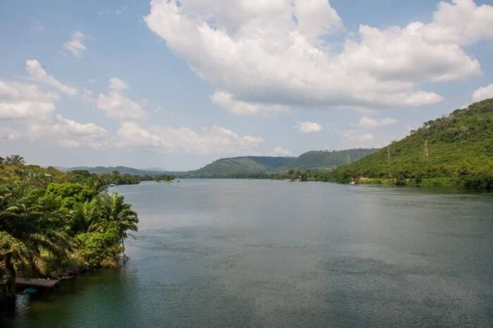
Crowbars
Belongs to the territory of the DR Congo. There are rapids and waterfalls along almost all the riverbed. The rainy season is from September to April. The water level is rising and the valley is flooding. The area around Lomami is home to monkeys and a flowering plant named after the river. Boats are used to travel downstream. In some areas of the shore the trees reach right down to the water.
The length of the river is 1500 km. 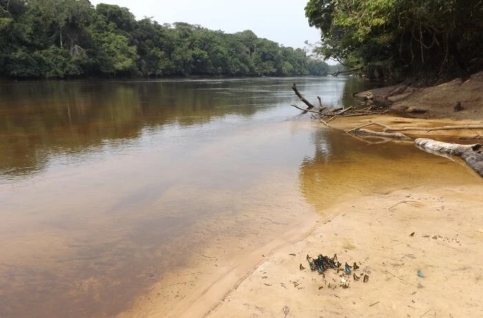
Benue
It is shared between Cameroon and Nigeria. It is one of the largest tributaries of the Niger. The shores and delta are densely populated, the lands are fertile and actively cultivated. Partially navigable, the rainy season increases the area accessible to ships. The Benue flood in 2012 led to the appearance of a huge number of poisonous snakes in the area.
The length of the river is 1400 km. 
Vaal
Located in South Africa, the largest tributary of the Orange. Reservoirs have been built on the river so that people do not depend on the season. The river is useful for agriculture and mining. A popular and modern aquatic center has opened in the city of Denisville. Here you can take scuba diving lessons and more. One of the entertainments for tourists is yachting.
The length of the river is 1250 km. 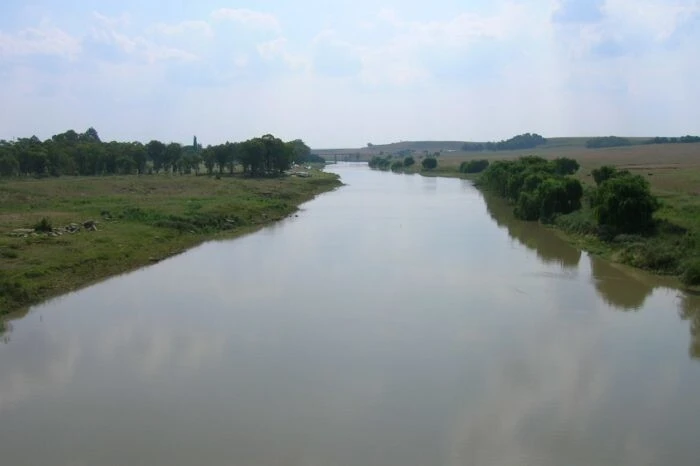
Kunene
It flows in the southwest of the continent. When it flows into the Atlantic Ocean, it forms several bays and diverges into wide branches. Crosses the Namib without drying out. Sometimes it spills, and the presence of dams and dams also affects the water level. The Kunene Delta has a visitor centre, a history museum and protected areas. The main attraction is the Ruacana waterfall.
The length of the river is 1207 km. 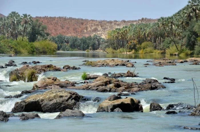
Avash
River in Ethiopia. It flows into Lake Abbe, but during dry periods it does not reach it. A national park of the same name was founded in the upper reaches. Here you can observe populations of antelopes and gazelles. The Awash Valley is included in the UNESCO World Heritage List. Numerous excavations have been carried out here. Evidence of human evolution and the remains of a female Australopithecus were found.
The length of the river is 1200 km. 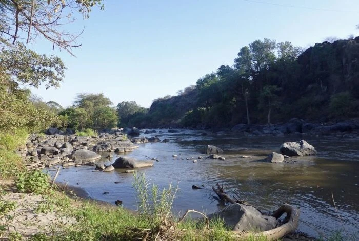
Draa
The longest river in Morocco, flowing along the border with Algeria. Over time, Draa's origins changed. Now it starts from the reservoir. The coastal zone is populated, with 23 villages and only 2 cities. There are rock carvings and stone figurines in the area. The earliest piece of art found here is over 300 thousand years old.
The length of the river is 1150 km. 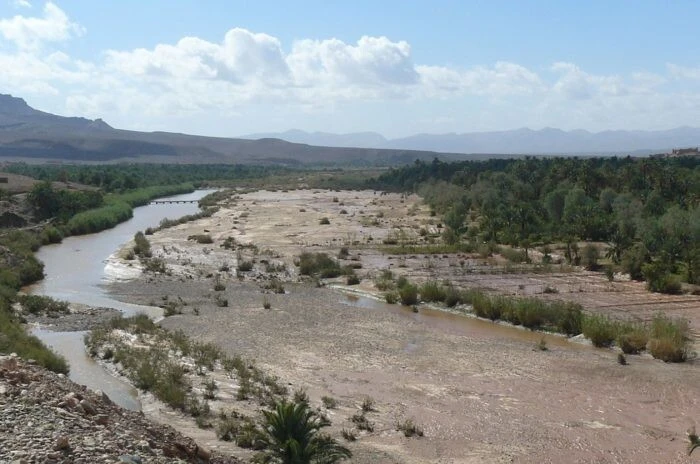
Gambia
Belongs to the western lands of Africa. Before flowing into the Atlantic Ocean it expands greatly. The city of Banjul is located on the river. Along the banks there are different species of birds, crocodiles, hippos, and gibbons. The relief and types of vegetation along the riverbed change each other. Mangrove forests give way to steep cliffs, and then dense thickets begin on the plains.
The length of the river is 1130 km. 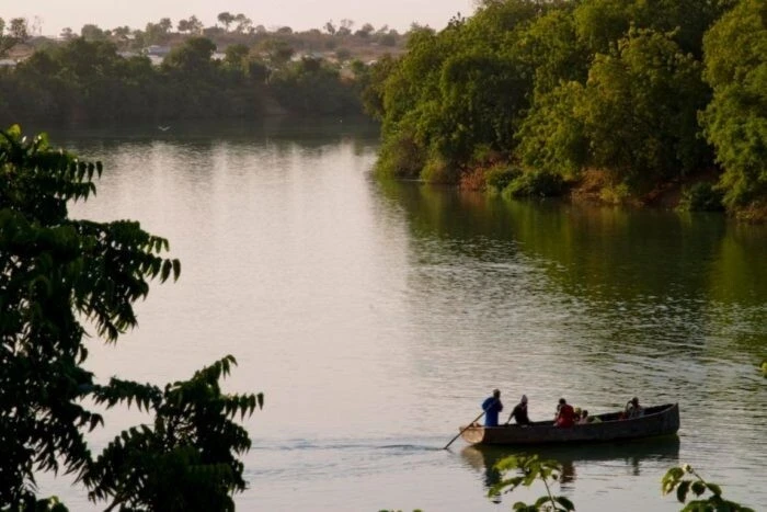
Uele
Belongs to the territory of the DR Congo. Upstream is called Kibalu. It originates in the Blue Mountains. It is a tributary of the Ubanga, and at its confluence it merges with the Mbomu. The rainy season lasts from March to October. The reservoir is partially polluted and appears reddish due to the increased content of iron oxide. A nearby attraction is Lake Albert.
The length of the river is 1130 km. 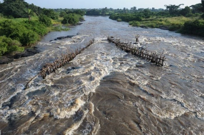
Bandama
The longest river in Côte d'Ivoire. In the 70s, a hydroelectric power station was built on it, which still supplies the region with electricity. At the same time, Lake Kossu was formed due to the dam. Rapids and low water levels limited navigation to a fairly small area. The largest city near the river is Yamoussoukro, the capital of the country. An annual rally is held along the riverbed.
The length of the river is 1050 km. 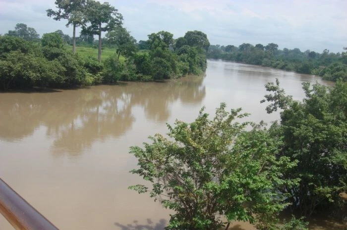
Kwanzaa
An Angolan river flowing into the Atlantic Ocean. Partially navigable with restrictions for large boats. The lower sector of the valley is used for agriculture, including the cultivation of sugar cane. The largest hydroelectric power station in the country, Kapanda, was built on the river. Kwanzaa is home to about 50 species of fish. Fishing is popular among both locals and visitors. Attraction: Lady Victoria Church.
The length of the river is 965 km. 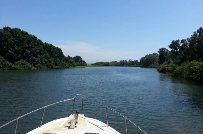
Oti
It flows in Western Africa in the territory of 4 countries. It flows into the Volta Reservoir. There are large tributaries such as Dudodo and Uke. The floodplains are used by local residents for grazing when drought occurs. During the rainy season, the coastal forest partially goes under water. There are hunting grounds and places for crops. Flows through 2 national parks: Pendjari and Oti Keran.
The length of the river is 900 km. 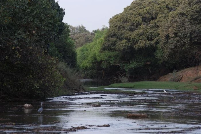
Kwando
It can be found in southwest Africa. Belongs to 4 countries, the source is in Angola. It is a right tributary of the Zambezi. Throughout the year, the intensity of the current changes noticeably. Some areas around the riverbed are swampy. Flows through or borders 6 national parks. Reserved and protected areas are designed to restore populations of different species of animals that have suffered in the past from poachers.
The length of the river is 800 km. 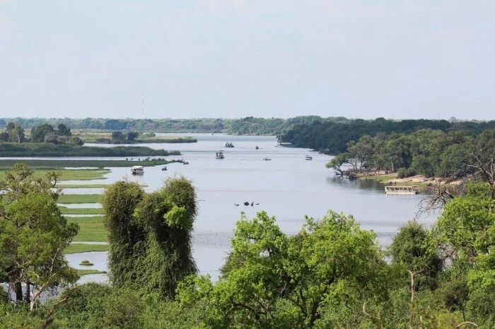
Luangwa
Applies to Zambia and Mozambique. Throughout the year, the strength of the flow changes, since it is fed by rain and the climate is arid. In the lower reaches the population density is high. The main activity of local residents is fishing. The catch is impressive even without special equipment and tools. Hunting reserves and national parks South Luangwa and North Luangwa have been established.
The length of the river is 770 km. 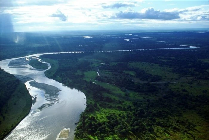
Omo
Ethiopian river flowing into Lake Rudolf. In the mountains it is much narrower than on the plain. There are rapids along almost the entire length. During the high-water period it is used for rafting. The construction of a cascade of hydroelectric power stations should solve the issue of providing the capital with electricity. The main attraction is the historical monument Omo-Kibish. The remains of the most ancient people were found here.
The length of the river is 760 km. 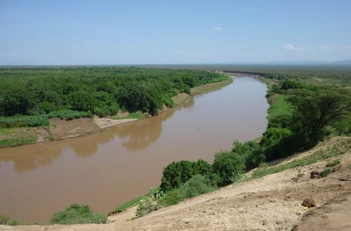
Jah
Cameroon River, one of the major tributaries of the Congo. It is navigable, but mostly small vessels can pass through. The delta is home to the Jah Faunaal Nature Reserve. Since 1987, it has been included in the UNESCO World Heritage List. Its goal is the preservation of the region's tropical forests. Nki National Park was also founded near the river. Poachers come here for ivory.
The length of the river is 720 km. 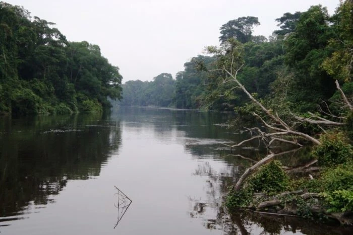
Fish
River in Namibia. It flows through the driest areas of the country, so part of the year it becomes shallow or completely dry. There is a reservoir formed due to the construction of a dam. This fresh water reservoir is a salvation for the region during particularly harsh periods. Cities are founded on the banks, although they have few inhabitants. Sights: the canyon of the same name and the Ai-Ais resort.
The length of the river is 650 km. 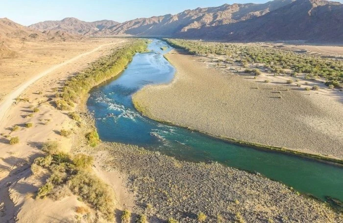
Kuiseb
A Namibian river flowing through the desert. It can dry out completely within a year. After heavy rains it fills with water again. Despite this inconstancy, it is important for the extremely arid region. It is the border of two relief zones. On one side lie deep red sand dunes, on the other are heathlands covered mostly with light-colored sand.
The length of the river is 560 km. 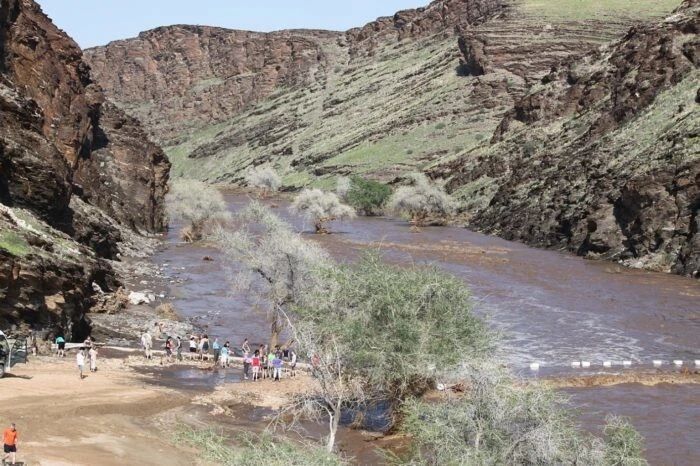
Umm al-Rbia
Flows through the territory of Morocco. Flows into the Atlantic Ocean. The flow is heterogeneous, in the mountains it is more stormy and rapid. In summer it becomes shallow, exposing sections of the bottom. Actively used for agricultural activities. Six dams regulate drainage and water levels from season to season. The main recharge comes from rain and melting mountain snow.
The length of the river is 556 km. 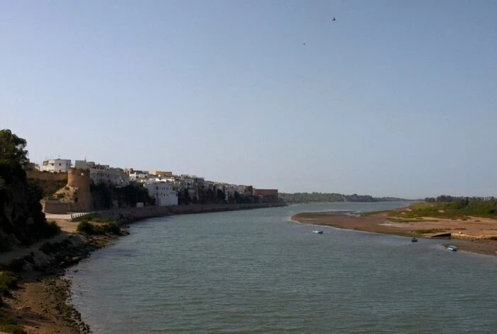
Tugela
Originates in the Drakensberg Mountains in South Africa. Numerous tributaries expanded the basin. Flows into the Indian Ocean. The occupations of local residents are agriculture and forestry. Among the ichthyofauna there are endemics. The main attraction is the waterfall of the same name, which is the highest in Africa. The Tugela was the border between the lands of the farmers and the Zulu kingdom.
The length of the river is 502 km. 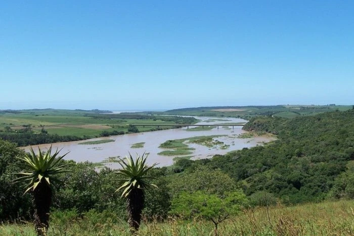
Jubba
The source is located on the border with Ethiopia, and the main part of the channel is in Somalia. Flows into the Indian Ocean. The river serves as an important waterway. Used to irrigate fertile fields. There is a lot of vegetation on its banks due to high humidity and large amounts of precipitation. Hyenas, gazelles, giraffes, and hippos gather to drink near the shore.
The length of the river is 497 km. 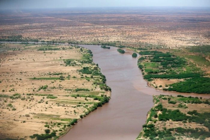
Ruaha
River of Tanzania. There are problems with drying out, so several large wildlife trusts are working on this issue. A national park of the same name was founded in the upper reaches. There is a hunting reserve in the lower reaches. Diverse flora and fauna, about 400 species of birds. Rich potential for fishing, partially realized. The river basin is densely populated.
The length of the river is 480 km. 
Mara
Occurs in Kenya and Tanzania. Flows into Lake Victoria. In the vicinity of the river, the Maasai Mara Nature Reserve is organized. The ungulates living in it make their migration routes through the Mara. For some of them, this route turns out to be fatal, since there are many crocodiles on the banks. A little further lies the territory of the Ikorongo Nature Reserve. Here the river makes several turns.
The length of the river is 395 km. 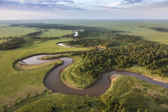
Salum
Belongs to the territory of Senegal. Flows into the Atlantic Ocean. In some areas it is very winding. Numerous turns of the riverbed in a small area create bizarre natural landscapes. Particularly picturesque sections of the coast are overgrown with mangrove forests. A national park of the same name has been formed in the Salum delta. Since 1981 it has been a biosphere reserve protected by UNESCO.
The length of the river is 250 km. 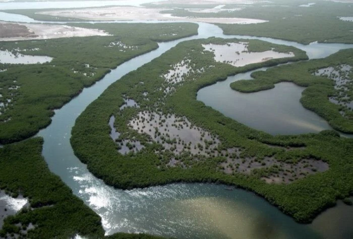
0 comments