There are several hundred large rivers in Australia. Most of them are shallow or completely dry, and only gain strength during the rainy season. One of the main features of local hydrology is the absence of a clearly defined seasonality of floods due to small and uneven precipitation. Another characteristic feature of Australia is that many bodies of water do not drain into the ocean. 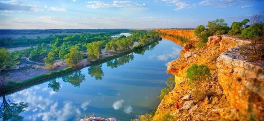
The largest rivers flow mainly in the southeast of the country. Instability of river channels is the reason for the poor development of passenger and freight water transport in Australia. Rivers are often used for organizing tourist trips on ships, trips on kayaks, canoes, and yachts.
Murray
River in southern Australia. Starts in the Australian Alps. The largest waterway on the continent. It flows into Lake Alexandrina and further into the Indian Ocean. Populated areas are Albury, Wodonga, Moama, Echuca, Mildura, etc. A system of dams and reservoirs has been built on the river. Crosses several national parks and reserves. It is famous for its inhabitants - Australian smelt, 3 species of perch, cod, clawed shrimp, and short-necked turtles.
The length of the river is 2508 km. 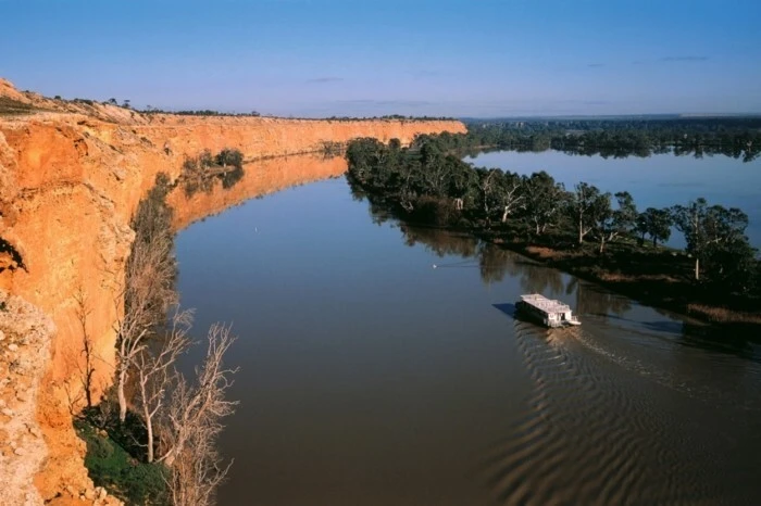
Murrumbidgee
Located in New South Wales and the Australian Capital Territory. Starts in the Australian Alps. Flows into the Murray River. Flows through major cities - Yass, Canberra, Hay, Wagga Wagga, Balranald. It was opened in 1823. A dam and several reservoirs were built, with the help of which the drainage is regulated. The river valley is famous for its picturesque nature. Several nature reserves have been created, hiking trails have been laid, canoeing and fishing are popular.
The length of the river is 1485 km. 
Darling
Located in New South Wales. Begins at the base of the New England Range. The longest tributary of the Murray. Cities - Burke, Brewarrina, Wentworth. Most of the year it is shallow; during the rainy season, the water rises by 10-15 meters. A system of reservoirs has been created in the lower reaches. Deposits of copper, gold, and silver were discovered. 6 national parks have been organized. Among the attractions are ancient sites, ritual sanctuaries of the aborigines, and fish traps that are 40 thousand years old.
The length of the river is 1472 km. 
Cooper Creek
Crosses Queensland and South Australia. It originates on the slope of the Warrego ridge, here the river is called Birku. Merging with the Thompson River, it becomes Cooper Creek. Settlements on the river are Blackall, Isisford. During floods it reaches Lake Eyre. It was first explored in 1845. It is a drying river that fills only during the rainy seasons, but the surrounding lands are fertile. There are many natural pastures along the banks.
The length of the river is 1420 km. 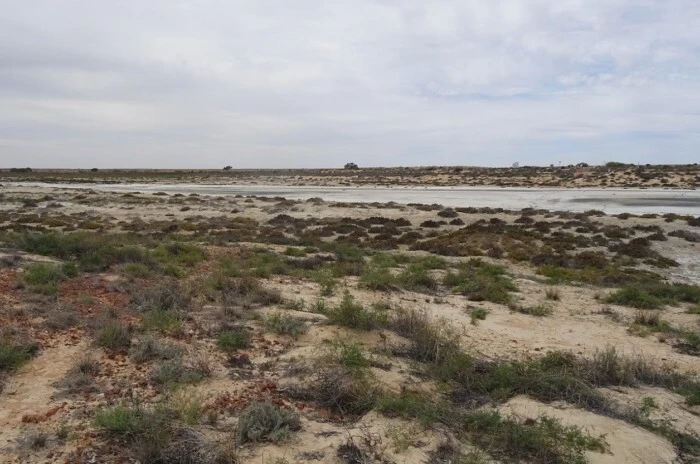
Lachlan
Located in New South Wales. Starts 13 km from Gunning. Flows into the Murrumbidgee River. Settlements are Kondobolin, Hilston, Buligal, Oxley, etc. The coastal lands have long been inhabited by aborigines - the Wiradjuri. The river is used for irrigation and a dam and reservoirs have been built on it. When the water rises, it becomes navigable. Floods occur frequently. Along its entire length there are wetlands, including those of national importance.
The length of the river is 1339 km. 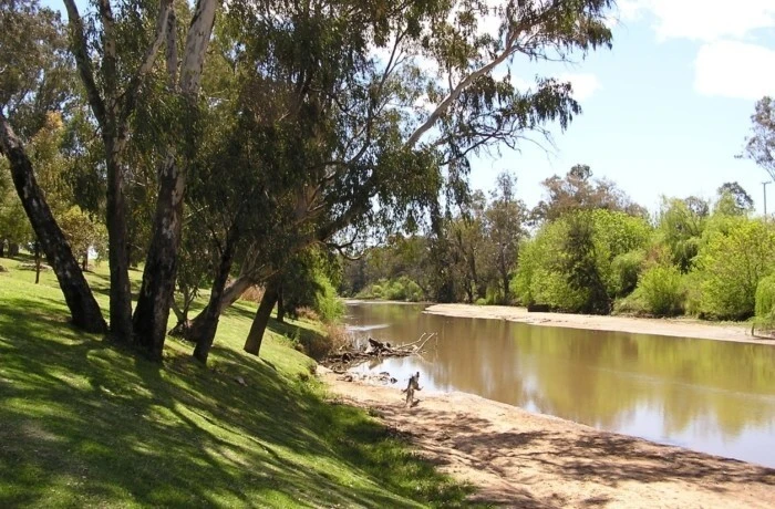
Flinders
It is the longest river in Queensland. The source is located on the slopes of the Gregory Mountains, near the city of Kargun. It flows into the Gulf of Carpentaria in northern Australia. It has several tributaries - Stoell, Saxby, Cloncurry. Flows through the cities of Hughenden, Marathon, Richmond. It was named in honor of M. Flinders, a British navigator. Coastal lands, especially closer to the bay, are used for raising sheep and cows.
The length of the river is 1004 km. 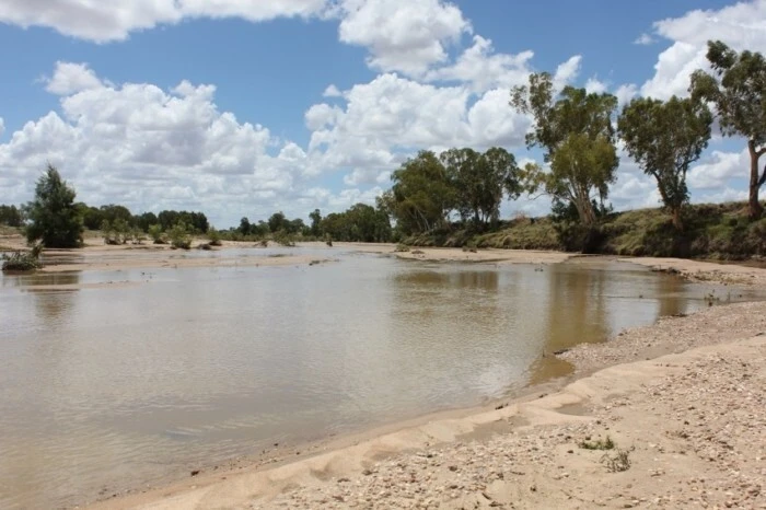
Gascoigne
Located in Western Australia. Starts at Robinson Hills. The longest river in this state. Flows into the Indian Ocean. It has 36 tributaries. It was opened in 1839. Flash floods are observed in May-July. Most of the year the river looks like a dry sandy bed. The Gascoigne is called a "reverse river" or "upside down river" because its aquifers lie below the level of the desert sands. At the mouth is the port city of Carnarvon.
The length of the river is 978 km.
Diamantina
Flows through Queensland and South Australia. It starts north of the village of Longreach. It flows into the Goydera Lagoon, a marshy lake in the Strzelecki Desert. During high water it overflows, flows out of the swamp, joins the Georgina River, and gives rise to Warburton Creek. The largest town on the river is Winton. The Diamantina National Park has been created in the surrounding area. In the river basin, livestock farming is well developed and there are many pastures.
The length of the river is 941 km. 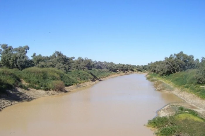
Ashburton
Located in Western Australia, in the Pilbara region. It flows into the Indian Ocean near the city of Onslow. It has many tributaries. There is little vegetation along the banks. In dry times it dries out completely. It was discovered in 1861 by traveler F. Gregory. The river is rich in fish, saltwater crocodiles have been spotted, and along the banks there are black swans, green night herons, Australian bustards and other birds.
The length of the river is 825 km. 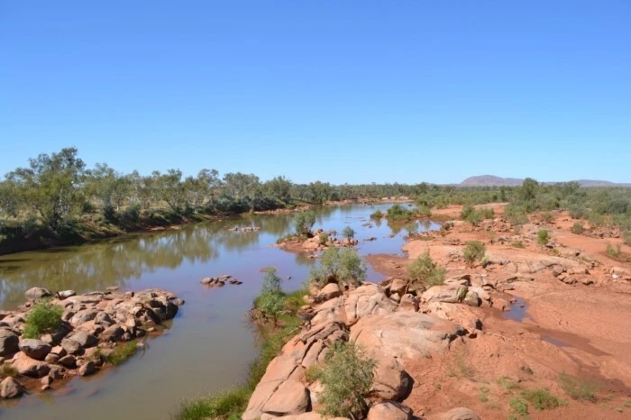
Murchison
The source is on the slope of Mount Robinson, in Western Australia. It flows into the Indian Ocean in the vicinity of the city of Kalbarri, the only populated area on this river. In 1839 it was first explored and named after R. Murchison, a geologist from Scotland. Kalbarri National Park was established near the river in 1963. During the dry season, the river dries up in many places.
The length of the river is 780 km. 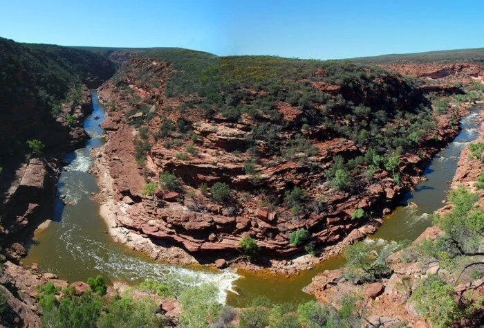
Fortescue
Flows in Western Australia, in the Pilbara region. The source is at Mount Deadman Hill, 30 km from the town of Newman. Flows into the Indian Ocean. It has 24 tributaries. It was discovered in 1861 by traveler F. Gregory and named after Charles Fortescue, who financed the expedition. Passes through Millstream Chichester National Park. Full of water in December-January, the rest of the time it dries up. A dam has been built. The coastal areas are inhabited by indigenous people - Injibandi.
The length of the river is 760 km. 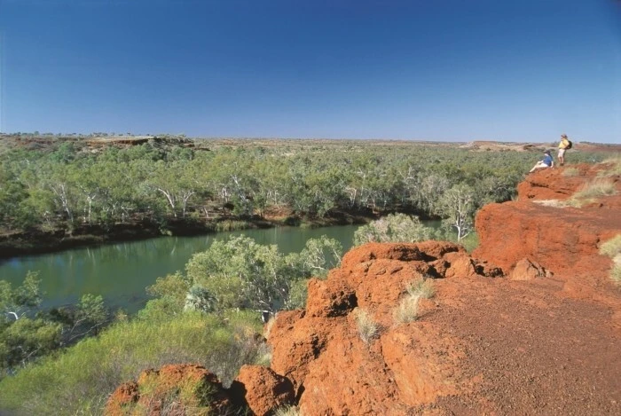
Fitzroy
Located in Western Australia, in the Kimberley region. The source is in the Durak Mountains. It flows into the Indian Ocean, King Bay. It was first explored in 1837 and named after the captain of the Beagle. A dam was built near the town of Camballin. The coastal areas are inhabited by aborigines who have lived here for at least 40 thousand years. The lands are used as pastures. In the upper reaches of the river is the city of Fitzroy Crossing, near which the Geikie Gorge National Park has been created.
The length of the river is 733 km. 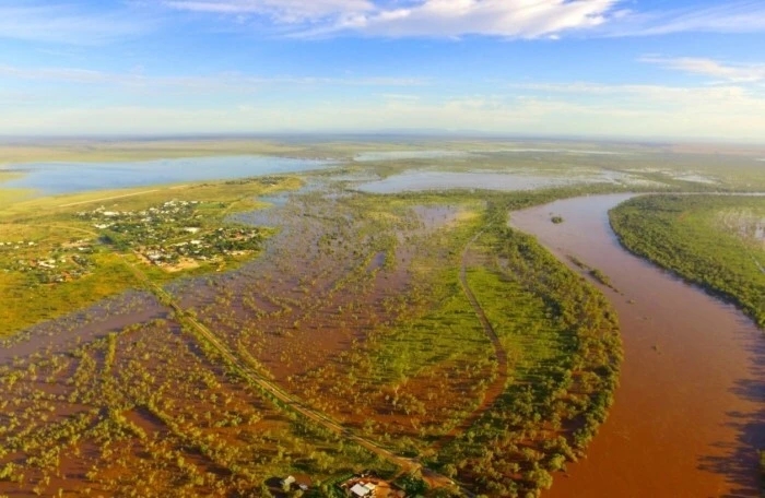
Berdekin
Located in Queensland. It starts on the slope of the Seaview Ridge, near the town of Ingham. It flows into the Coral Sea in the area of Upstart Bay. Flows through the communities of Charters Towers, Home Hill, Ayr, and Collinsville. It was opened in 1839. The largest dam in the state was built on the river. The main activities in the Burdekin Basin are livestock farming and sugarcane cultivation. Girringoon National Park is located in the surrounding area.
The length of the river is 732 km. 
Barwon
Located in New South Wales. Formed by the confluence of the Weir and Macintyre rivers, north of the town of Mungindi. Flows into the Darling River. It has 36 tributaries. The towns on the river are Collarenebri, Walgett, Brewarrina. It was first explored in 1846. The history and culture of the local Aboriginal people are closely connected with the river. Ancient stone fish traps have been preserved. Due to their uniqueness, they are included in the Australian National Heritage List.
The length of the river is 700 km. 
Condamine
Located in Queensland. Starts at Mount Superbus. Flows into the Darling River. Settlements on the river are Killarney, Warwick, Chinchilla, Surat. It was opened in 1827. The water is used to irrigate coastal lands. Several dams have been built on the river. Large-scale floods occur. During drought, the Condamine turns into a chain of drying up ponds. Natural gas is being extracted on the coast near the city of Chinchilla.
The length of the river is 657 km. 
Goulburn
Located in Victoria. The longest river in the state. The source is in the Victorian Alps. It flows into the Murray River near the city of Echuca. It has 41 tributaries. The settlements on the river are Alexandra, Seymour, Murchison, Nagambie, Arcadia Downs, etc. It was opened in 1824. Lower Goulburn National Park was created in 2010 to protect the region's unique coastal forests, which are over 500 years old. Canoeing, fishing, and picnics on the shore are popular.
The length of the river is 654 km. 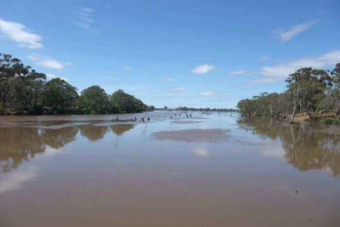
Fink
Located in Central Australia. The source is at the MacDonnell Ridge. Usually a chain of lakes and reservoirs, the channel is lost in the Simpson Desert. Only after rainfalls does it become full-flowing and flow into the Macumba River. It is considered the oldest river in the world, its approximate age is about 400 million years. It was opened in 1860. It flows through two national parks of the country - Fink Godge and West MacDonnell. Colonies of migratory birds live on the banks.
The length of the river is 600 km. 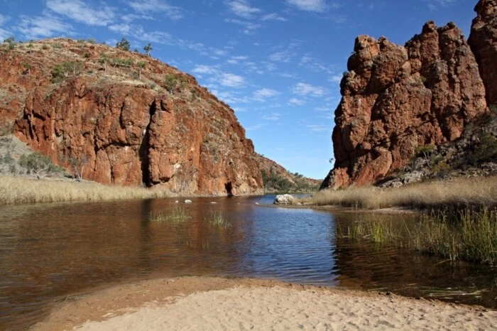
Barku
Located in Queensland. The source is on the slopes of the Warrego ridge. Connects with the Thompson River to give rise to Cooper Creek. Settlements on the coast are Blackall, Isisford, Tambo, Retreat. It was first explored in 1845, the name was given by local aborigines. Has 4 tributaries. Isisford Dam was built on the river. Welford National Park is located in the surrounding area. The river is home to Australian endemics - the Barcoo River perch.
The length of the river is 580 km. 
Victoria
Flows through the Northern Territory of Australia. The source is in the hilly area north of the town of Lajamanu. Flows into the Timor Sea. Localities - Coolibah, Victoria River Downs. It has 56 tributaries. It was opened in 1839. It is full of water from December to March, and becomes shallow during the dry season. In the surrounding area is Judeburra National Park. In the lower reaches there are valuable wetlands - habitat for large colonies of waterfowl and migratory birds.
The length of the river is 560 km. 
Castlereagh
Located in New South Wales. The source is in the Warrumbungle Mountains, at an altitude of 850 meters. It flows into the Macquarie River, 65 km from Walgett. Settlements: Coonabarabran, Binnaway, Menduoran, Gilgandra. It was first explored in 1818. In many areas it becomes an "inverted river", meaning water flows through extensive sands below the riverbed. During floods it is a turbulent stream and floods occur. The coastal lands have long been inhabited by Aboriginal people.
The length of the river is 549 km. 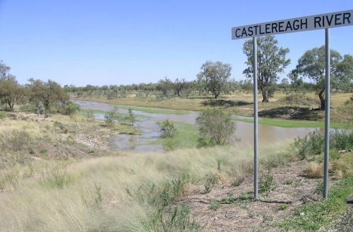
Warburton
Located in South Australia. One of the largest rivers in the state. Starts in the swampy lake Goydera Lagoon. It flows through several bodies of water, permanent and dry, desert terrain and flows into Australia's largest lake, Lake Eyre. It has 7 tributaries. It was discovered in 1866 by the English traveler Peter Warburton and subsequently received his name. Coastal lands are used mainly as grazing lands.
The length of the river is 412 km. 
Swan
Located in Western Australia. It starts from the Avon River, its source is on the Darling Range. Within the park, the Walunga connects with tributaries and turns into the Swan River. Flows through the cities of Northam, Perth. Near the city of Fremantle it flows into the Indian Ocean. It was discovered in 1697 and got its name in honor of the black swans that live here. 22 bridges were built across the river. Cruises are popular; there are 15 yacht clubs and several rowing clubs along the river.
The length of the river is 360 km. 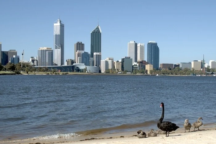
Snowy
The source of the river is at the foot of Mount Kosciuszko, the highest in Australia, in the territory of the national park of the same name. Crosses New South Wales and Victoria. In Victoria it flows through 2 parks - Alpine and Snowy Rivers. Flows into Bass Strait. Settlements on the river are Cooma, Jindabyne, Dalgety, Orbost, Marlowe. It was explored in 1839. To regulate the watershed on the river, several dams and reservoirs were built.
The length of the river is 352 km. 
Brisbane
Located in Queensland. Starts at Conondale Park. Flows into Moreton Bay. Major floods often occur in the lower reaches. Habitat of rare fish - cattail, Brisbane River cod, bull sharks. 1 underwater tunnel and 16 bridges were built on the river. Most of them are in the city of Brisbane, at the mouth of the river. Kayaking, canoeing, and retro cruises on a gondola or paddle steamer are popular. There are areas of mangroves.
The length of the river is 344 km. 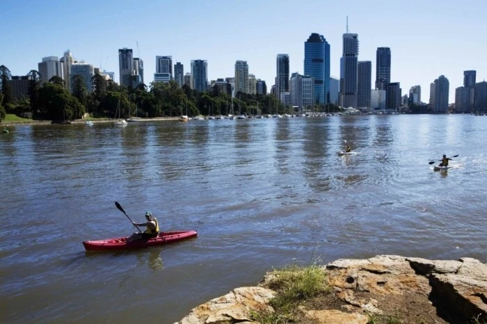
Ord
Located in Western Australia. The source is at the foot of Mount Wells. Flows into the Timor Sea. Settlements on the river are Lake Argyll, Kununurra. It flows through the largest body of fresh water - Lake Argyll and Purnululu National Park. It was opened in 1879. An irrigation system, several dams, and a hydroelectric power station were built on the Orda. Peanuts, sunflowers, and sugar cane are grown on coastal lands. River cruises and fishing are popular.
The length of the river is 320 km. 
Hunter
Flows in New South Wales. Starts in the Liverpool Mountains. It flows into the Tasman Sea. It was discovered in 1791, at the same time large deposits of coal were discovered. And today the city of Newcastle at the mouth of the river is among the world leaders in its export. The Hunter Valley is one of Australia's most famous wine regions. There are frequent floods and a dam has been built. Along the banks there are mangroves. Cities on the river are Aberdeen, Denman, Singleton, Maitland and others.
The length of the river is 300 km. 
Mary
Located in Queensland. It starts near the village of Burubin. Settlements on the coast are Kenilworth, Tiaro, Maryborough, Gympie. It flows into the narrow Great Sandy Strait. First explored in 1842. It is famous for its inhabitants - ancient turtles, which are preserved only in this river. Also found are the rare cattail lungfish, giant frogs and saltwater crocodiles. A national park of the same name has been created in the vicinity of the river.
The length of the river is 291 km. 
Yarra
Located in Victoria. Starts near Mount Matlock. The mouth is in the bay of Port Phillip Bay. It was opened in 1803. Downstream, the second largest Australian city, Melbourne, is founded. Also on the river are the small towns of Warburton, Yarra Junction, and Warrandyte. The Yarra River Valley outside Melbourne is famous for its luxurious vineyards and the best wineries in the province, as well as numerous parks and reserves.
The length of the river is 242 km. 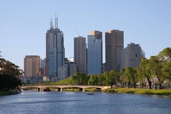
Derwent
The source of the river is Lake St. Clair in the central part of the island of Tasmania. It flows into Storm Bay, which is connected to the Tasman Sea. Several hydroelectric power stations were built on the river, resulting in the formation of artificial reservoirs. Flows through the Cradle Mountain-Lake St. Clair World Heritage Park. The river is rich in fish, about a hundred species of birds live here, and among the mammals there are dolphins, seals, and whales.
The length of the river is 215 km. 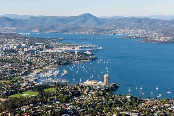
Gordon
Flows in the southern part of the island of Tasmania. The source is in Lake Richmond, near Mount King William. It flows into Lake Gordon, the largest on the island, which was formed after the construction of the dam. Further through Macquarie Gulf it enters the Indian Ocean. It has 25 tributaries. Located within the Franklin Gordon Wild Rivers Park, part of the Tasmanian Wilderness World Heritage Site. Boat excursions and seaplane flights are popular.
The length of the river is 186 km. 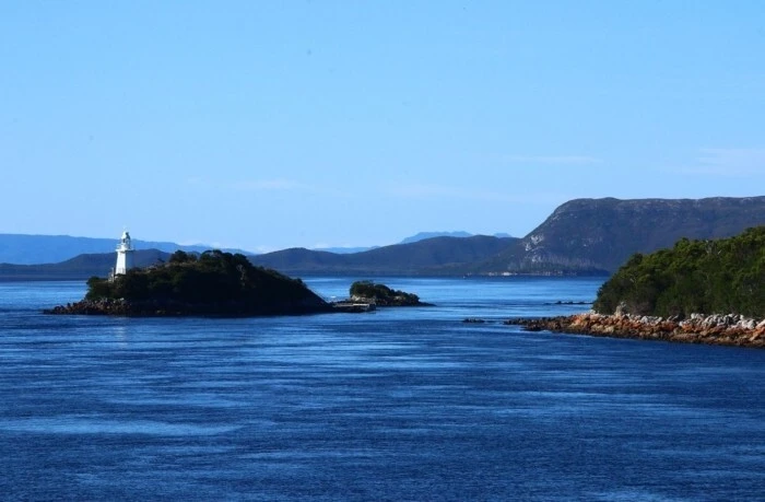
0 comments