17 examples of unusual display of the world using maps (18 photos)
How quotes differ in different countries, where there are the most domestic cats and red-haired people - all this can be seen on these 17 maps! 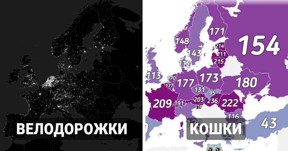
If you thought that maps, globes and other attributes of geography lessons were a thing of the past, then we hasten to please you - they are still popular in the adult world. True, they celebrate not boring things, but interesting moments that help us learn about the world around us from a different perspective. How quotes differ in different countries, where there are the most domestic cats and red-haired people - all this can be seen on these 17 maps!
1. What quotation marks look like in different European countries 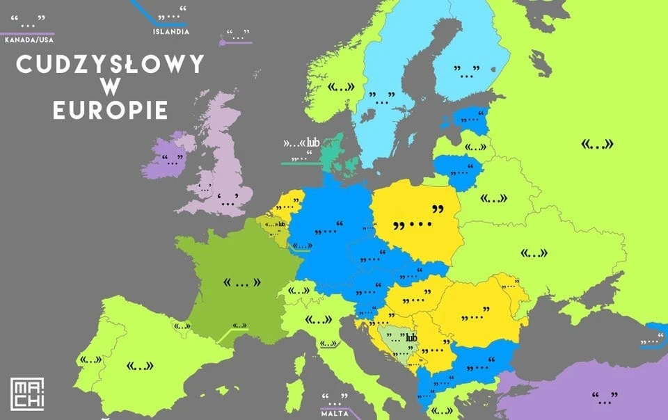
2. What does the railway network look like? 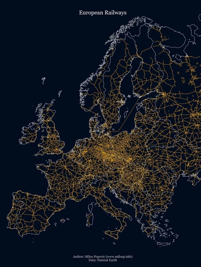
3. Number of domestic cats in European countries per 1000 people - excluding stray animals 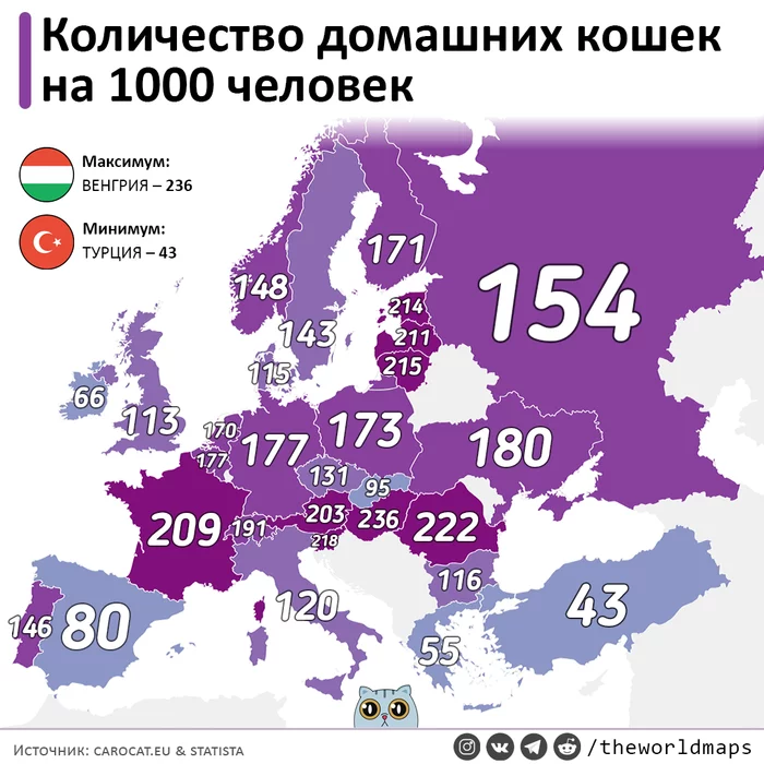
4. Which country do these countries have the longest border with? 
5. Maximum speed limit on roads 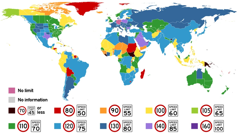
6. The Roman Empire in 117 AD - at that time it reached the maximum of its territory 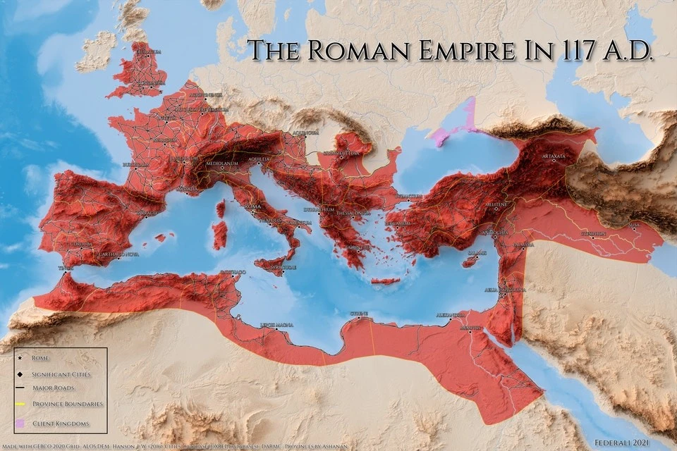
7. Habitats of big cats 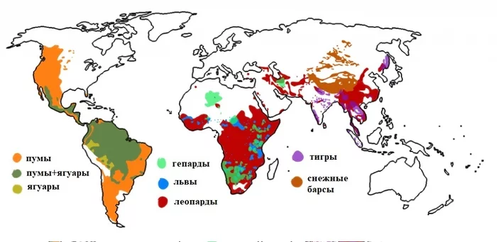
8. European cycle map 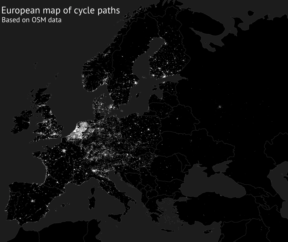
Some bike paths may not be marked on this map. It is made based on data from the OpenStreetMap portal, where users themselves add information.
9. What cities look like in different countries 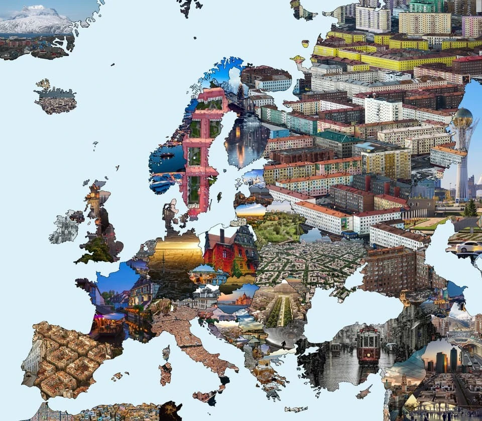
10. Map of red-haired people 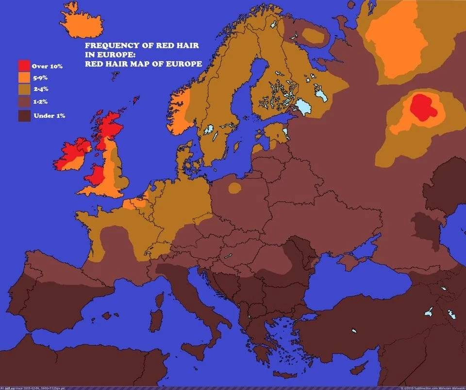
11. Maximum thermometer readings for the entire history of meteorological observations, indicated in °C 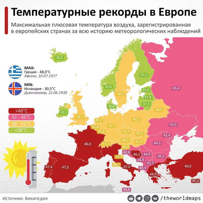
12. Hats in different countries 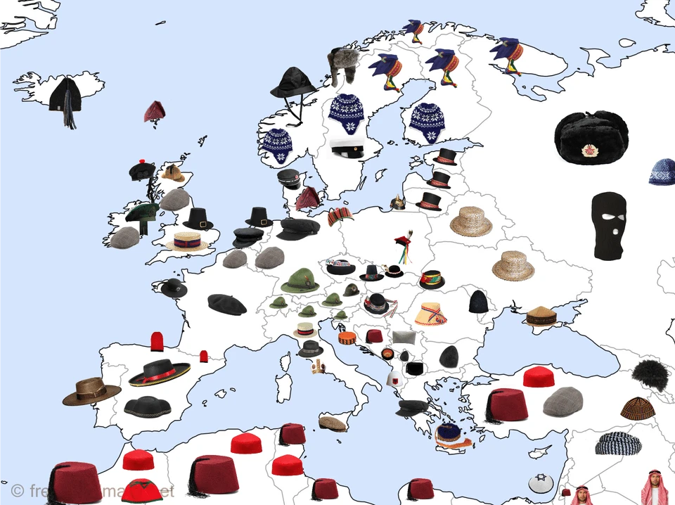
13. What would the same girl look like in different countries? 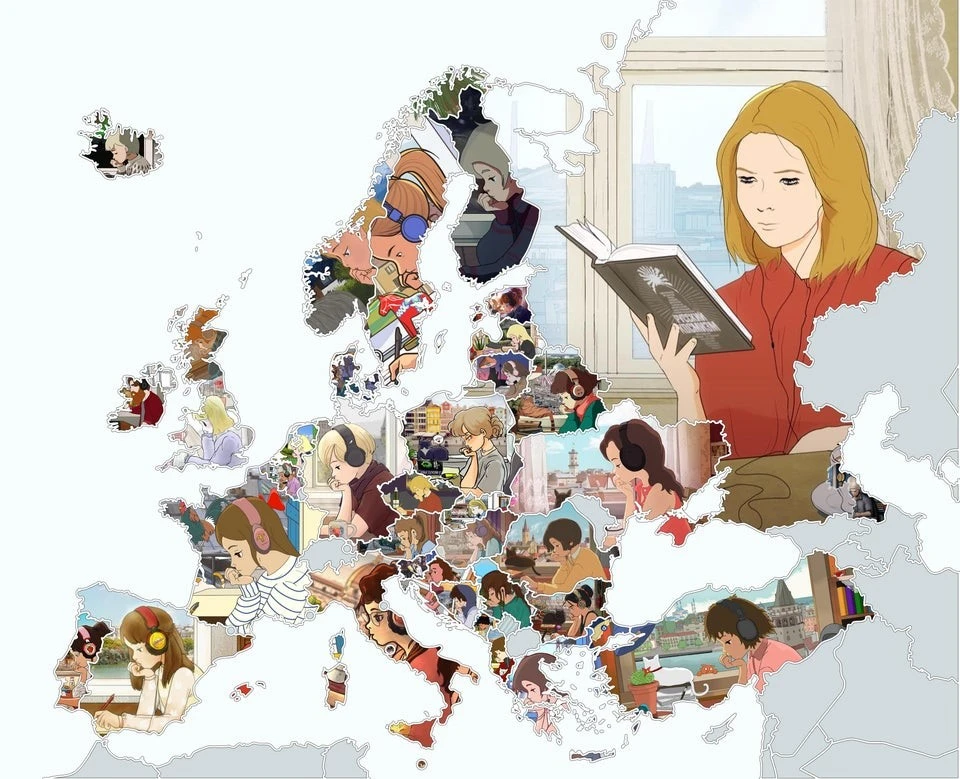
14. Citizens of which countries have visited the ISS since the beginning of its operation? 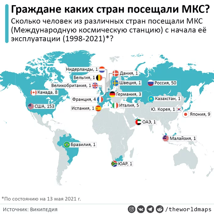
15. In the yellow section of the map you will be closer to London, and in the blue section you will be closer to Paris 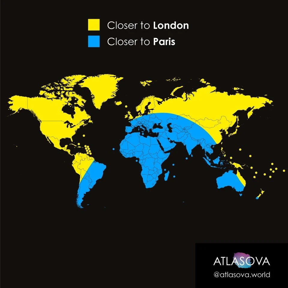
16. What military uniforms of different countries looked like during the First World War 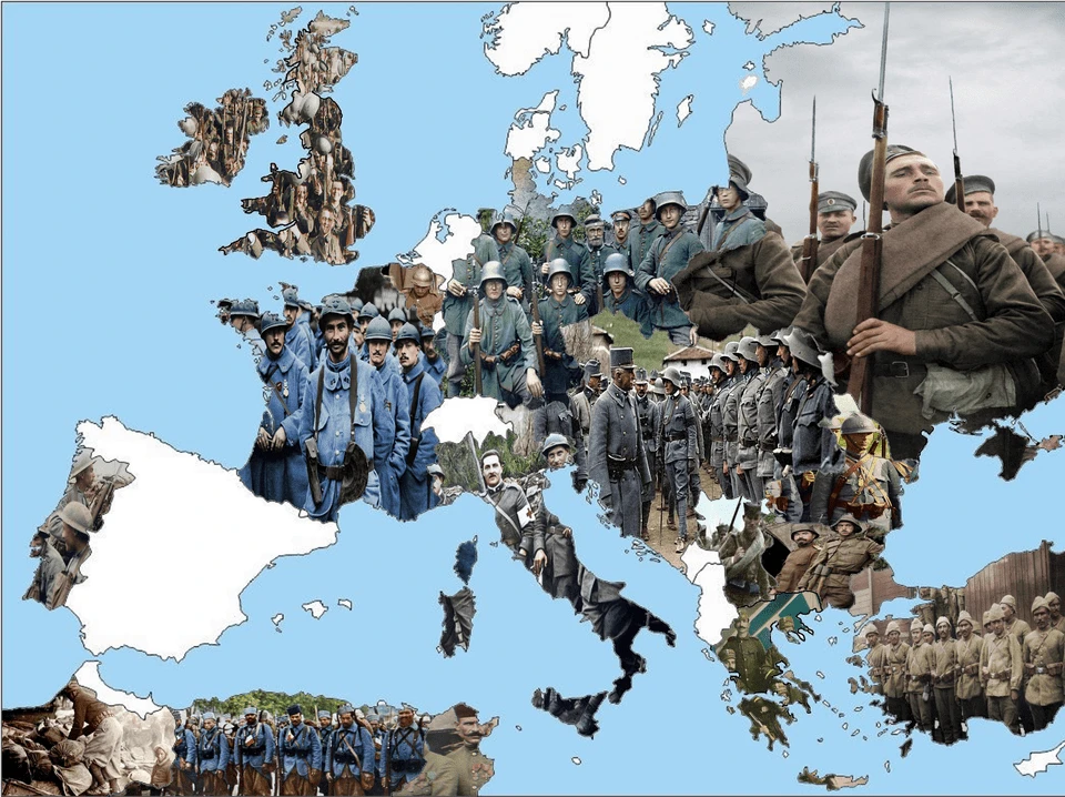
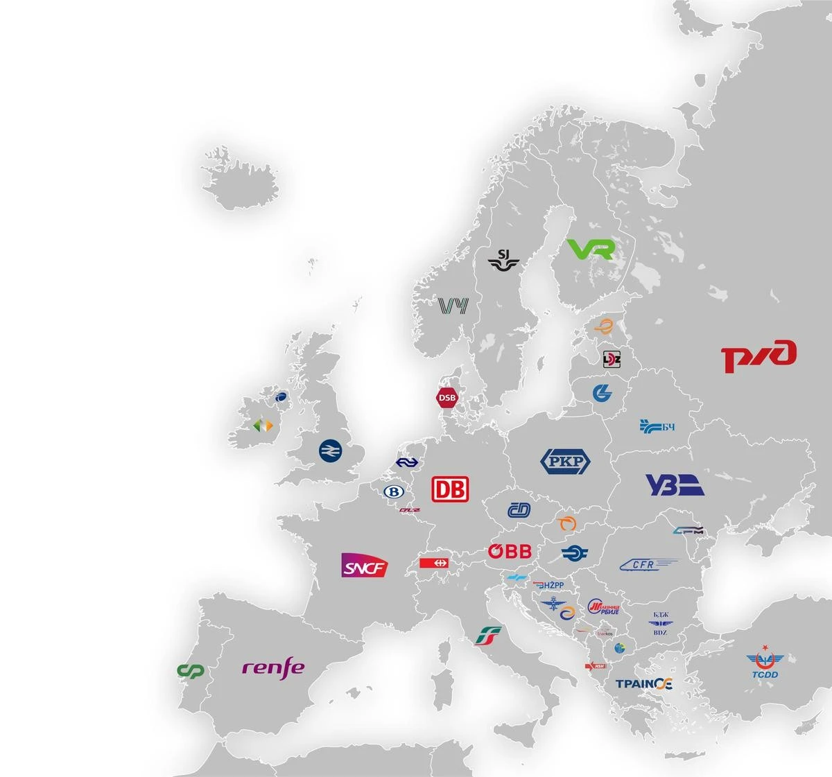
17. Logos of railway companies