Did you know that the state border between countries can run right in the middle of the bed? And this is so! I've collected some fun examples of state borders. 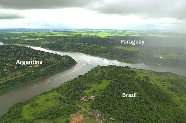
Border between Belgium and the Netherlands in the city of Baarle 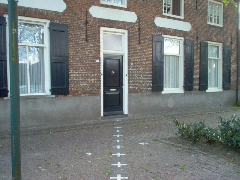
And here, apparently, citizenship is determined by which way the door opens...
The border between the two countries passes through the territory of the town, and divides it into two unequal parts. If the border passes through a house, then the ownership of the house is determined by the front door. Thus, if the front door is on Belgian territory, it means that Belgians live in the house. But if it’s the other way around, then Dutch citizens live in the house :).
Border between France and Switzerland in the village of La Croux 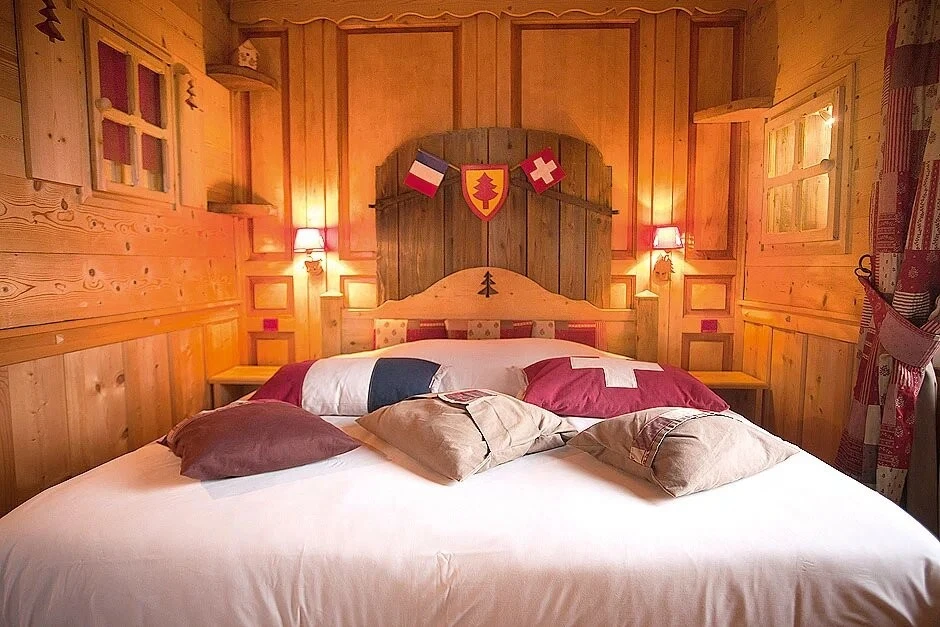
So this is where the expression “one foot there, one foot there” comes from...
And here the border between the two states passes “through the houses.” The Arbez Hotel building was the luckiest. The border runs exactly in the middle of one of the numbers. Thus, when you go to bed, you sleep on the territory of France, and your wife on the territory of Switzerland. Or vice versa.
US-Mexico border in Tijuana 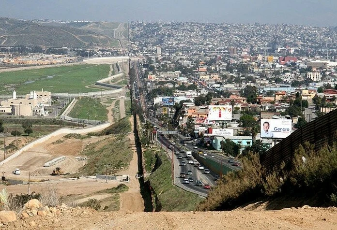
USA on the left, Mexico on the right
Americans keep their side of the border empty to make it easier to catch illegal migrants.
Border between Egypt and Israel 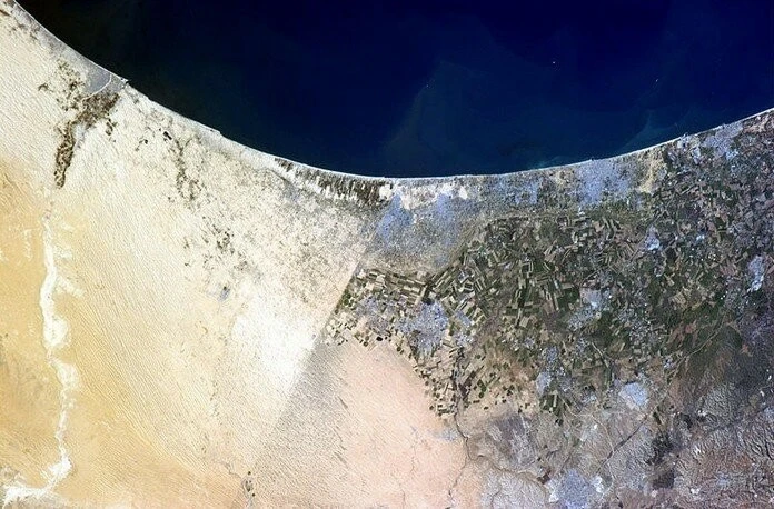
Egypt on the left, Israel on the right
The satellite image clearly shows where the border lies. People live in Israel, build houses, build roads, parks and lawns are visible. In Egypt there is only sand.
Border between China and Nepal 
The border between China and Nepal passes through Mount Everest. If we “weigh it in grams,” then 70% of the mountain is in Tibet, the remaining part is in Nepal.
Border between Brazil, Paraguay and Argentina 
"La Tripla" - the triple border between countries
The countries are separated by the Iguazu and Parana rivers. Interestingly, there is no border crossing between Argentina and Paraguay. First you need to swim to Brazil, put a mark in your passport there, and only then swim to Paraguay. You can visit three countries in one hour.
Border between Haiti and Dominican Republic 
On the left is Haiti, on the right is the Dominican Republic
Another satellite image, and the border between the two countries is clearly visible. The emptiness on the left is explained by the following - in Haiti you can cut down the forest. But in the Dominican Republic you can’t.
Border between North Korea and South Korea 
North Korea in the dark
On the left is a people's democratic republic, and on the right is a capitalist republic. It’s strange that with “people’s democracy” there is no light :)
0 comments